1/8
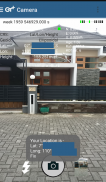
Geotagging+ screenshot 0
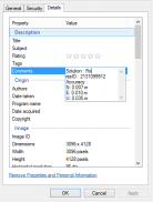
Geotagging+ screenshot 1
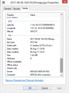
Geotagging+ screenshot 2
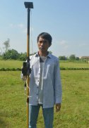
Geotagging+ screenshot 3
Geotagging+ screenshot 4
Geotagging+ screenshot 5
Geotagging+ screenshot 6
Geotagging+ screenshot 7
Geotagging+ Icon

Geotagging+

Nuaim Hammad Ausi
Trustable Ranking Icon信頼済
1K+ダウンロード
17MBサイズ
Android Version Icon4.0.1 - 4.0.2+
Androidバージョン
1.1(29-06-2018)最新バージョン
-
(0 レビュー)
Age ratingPEGI-3
ダウンロード
詳細レビューバージョン情報
1/8

Geotagging+の説明

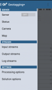
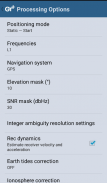
This app allows you to take image and measure with low-cost GNSS module (like U-blox GNSS module or E-GNSS from potretudara : http://www.potretudara.com/low-cost-gps-gis/ ). Measured coordinates from low-cost GNSS module are stored to EXIF image metadata in time when you tap the "capture" button. Use this to create your geotagging more precise to sub-meter level. Very useful for census, GIS support, reporting issue, and others.


You can still use internal GNSS for geotagging by deactivate BASE and ROVER in the Input Stream menu. Obviously none of the precision algorithm found in RTKLIB can be use.


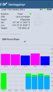
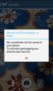
Image taken by this app will have coordinate metadata, accuracy, and solution type (internal, single, float, or fix).


Heavily based on RtkGps+ from Ronan LE MEILLAT, this is a fork of his work. Original licenses are in the "About/Legacy Info" screen. Thanks to all contributors to respect this clause.


This app is RTKGPS+-like with additional Camera menu. You still can use this app for surveying, tracking, etc. like RTKGPS+ do.


This app is a port of RTKLIB 2.4.3b 28 developed by Tomoji Takasu (http://http://www.rtklib.com/). This RTKLIB 2.4.3 is modified by rtklibexplorer and named RTKLIB 2.4.3 demo 5 b 28 (https://github.com/rtklibexplorer/RTKLIB). If you do not know what this application is, this application is probably not what you are looking for!


App manual : http://bit.ly/shortmanual

Geotagging+ - バージョン 1.1

(29-06-2018)
他のバージョン
新機能は* Merge to RTKLIB demo 5 b 28 (update rtklibexplorer 5/8/2017)* Add Height-metadata on photo taken* Fix solution-metadata (internal/single/float/fix) on some devices* Fix input negative LLH/ECEF coordinate base station position

まだ、レビューや評価はありません。 して最初のレビューワーになってください。

-
0 Reviews
5
4
3
2
1

Geotagging+- APK情報

APKバージョン: 1.1パッケージ: com.geotaggingplusfree
Androidでの対応: 4.0.1 - 4.0.2+ (Ice Cream Sandwich)
開発者:Nuaim Hammad Ausiプライバシーポリシー:https://github.com/ausioz許可:12
名前: Geotagging+サイズ: 17 MBダウンロード: 7バージョン : 1.1リリース日: 2018-06-29 18:52:35最小スクリーン: SMALLサポートされたCPU: x86, armeabi, armeabi-v7a, mips
パッケージ ID: com.geotaggingplusfreeSHA1署名: F8:CE:A3:16:6D:39:C8:BD:54:40:88:1D:00:FA:C3:DF:1A:F9:16:9C開発者 (CN): Nuaim Hammad Ausi組織 (O): 地域 (L): 国 (C): 都道府県/州/市 (ST): パッケージ ID: com.geotaggingplusfreeSHA1署名: F8:CE:A3:16:6D:39:C8:BD:54:40:88:1D:00:FA:C3:DF:1A:F9:16:9C開発者 (CN): Nuaim Hammad Ausi組織 (O): 地域 (L): 国 (C): 都道府県/州/市 (ST):

Geotagging+の最新バージョン

1.1Trust Icon Versions
29/6/2018
7 ダウンロード17 MB サイズ
ダウンロード
appcoins-gift
ボーナスゲームさらに多くの報酬を獲得!
さらに
Super Sus
Super Sus icon
ダウンロード
Tiki Solitaire TriPeaks
Tiki Solitaire TriPeaks icon
ダウンロード
三国志之逐鹿中原
三国志之逐鹿中原 icon
ダウンロード
クラッシュオブキングス
クラッシュオブキングス icon
ダウンロード
レイド:  Shadow Legends
レイド:  Shadow Legends icon
ダウンロード
Clash of Kings:The West
Clash of Kings:The West icon
ダウンロード
麻雀パズルゲーム
麻雀パズルゲーム icon
ダウンロード
Goods Sort-sort puzzle
Goods Sort-sort puzzle icon
ダウンロード